Work with a Team That Gets It
We know how to use infrastructure data in real design and build environments — not just on paper. Whether you're planning a rollout or refining existing networks, we’ll help you take full advantage of NUAR.
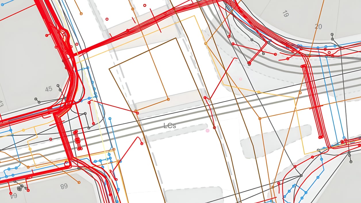
The National Underground Asset Register (NUAR) is a government-led initiative designed to bring together data from utility companies, local authorities, and other organisations into a single, standardised digital map of underground infrastructure across the UK.
Instead of having to contact multiple utilities individually to request plans before digging, NUAR provides a secure, centralised platform that makes it quicker and easier to view the location of buried assets like pipes, cables, and ducts.
It’s aimed at improving safety, reducing accidental damage, and streamlining planning and excavation work. For anyone involved in construction, utilities, or geospatial planning, NUAR is set to become a vital tool in day-to-day operations.
We factor buried infrastructure into our high-level and single-line designs — reducing rework and avoiding risks before build even begins.
We overlay NUAR data with your planned routes to catch conflicts early. No surprises, no digging into trouble.
Our team uses geospatial tools to align your designs with real-world conditions — streamlining approvals and keeping crews informed.
NUAR data is built into the packs we deliver for field teams — making sure everyone knows what’s below before breaking ground.
If you manage or supply infrastructure data, we help clean, align, and prepare it for NUAR compliance.
We know how to use infrastructure data in real design and build environments — not just on paper. Whether you're planning a rollout or refining existing networks, we’ll help you take full advantage of NUAR.